Monday, February 19, 2024

Lost in the Thornscrub—A Report from the 2023 Meeting of Texas Master Naturalists

Laguna Atascosa National Wildlife Refuge

As the Texas Master Naturalist program has grown over the past twenty-five years, the annual state meeting has evolved from the informal “camp style” gatherings of earlier years to full blown professional conferences at resort hotels. Of the more than 100 Advanced Training opportunities at the most recent meeting in McAllen, twenty were field sessions that allowed attendees to explore the diverse ecosystems of the Lower Rio Grande Valley. Of all the sessions offered, the field trips are the highlight of this annual October event.


The first field session I attended was a pre-conference all-day exploration of four coastal sites devoted to the conservation of South Texas habitat and preservation of wildlife. The field session, entitled "Coastal Conservation Cooperative," began with a stop at Cactus Creek Ranch, a privately owned wildlife conservation ranch and learning center. After breakfast and orientation by owner and operator Mary Jo Bogatto, we toured the property and learned about its transformation from overgrazed cattle ranch to "re-wilded" coastal prairie and thornscrub forest, a process aided by the planting of more than 200,000 native grasses and forbs. On an hour-long hike, we encountered several gulf marsh fiddler crabs (Minuca longisignalis), and one of our group picked one up and learned how to distinguish males from females. After getting back on the van and leaving Cactus Creek Ranch, we saw a flock of wood storks (Mycteria americana) on the edge of a pond. 

American Alligator


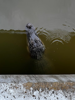
Equally thrilling was spotting a trio of American alligators (Alligator mississippiensis) under a highway bridge as we drove to our next stop, Laguna Atascosa National Wildlife Refuge, a coastal preserve encompassing 110,000 acres. We explored this pristine landscape with stops along the fourteen-mile Steve Thompson Wildlife Drive, a coastal prairie loop. At one of our stops, we hiked down a path that tunneled through the dense growth of Tamaulipan thornscrub. From a viewing platform, we looked over coastal wetland habitats and Laguna Madre Bay. We also observed several native animals, including a Texas tortoise (Gopherus berlandieri), a javelina (Dicotyles tajacu), and several brilliantly colored green jays (Cyanocorax yncas). In the distance we glimpsed nilgai (Boselaphus tragocamelus), a species of antelope introduced to South Texas from Southeast Asia in the 1950s.


Texas Tortoise


Our third stop was the South Padre Island Birding and Nature Center, whose mission is to educate the public about the flora and fauna of the island with the goal of expanding environmental awareness. Our guide for the entire day, Javier Gonzalez, works as a Naturalist Educator at the Birding and Nature Center and, in that capacity, led us on a tour of tidal wetlands. From the vantage point of boardwalks and blinds extending over the water, we saw dozens of species of native birds, including reddish egrets (Egretta rufescens), brown pelicans (Pelecanus occidentalis), and common gallinules (Gallinula galeata).


We ended the day with a tour of the South Texas Ecotourism Center, which, in addition to highlighting the natural assets of South Texas, provides an active demonstration of stormwater management through the restoration and preservation of the Laguna Madre, one of only six of the world’s hypersaline coastal lagoons (which are saltier than normal seawater). This unique ecosystem is visible from an extended ramp and viewing platform; perched high above the flats, we had an uninterrupted view of this fragile landscape.


South Texas Ecotourism Center


While the all-day coastal field trip offered the most immersive experiences, two half-day adventures were also rewarding. The next morning I joined dozens of other Master Naturalists at the National Butterfly Center, a 100-acre site dedicated to the conservation and study of butterflies in their native habitats. The native botanical garden attracts butterflies, other pollinators, and birds. The purpose of our visit, as we explored the garden and trails, was to participate in a bioblitz led by Wendy Anderson, a Texas Nature Trackers Biologist with Texas Parks and Wildlife Department. Our observations automatically populated an iNaturalist project created for the state meeting that covered every major natural site in South Texas. Only thirty-six observers participated during the five days of the conference, but their contributions were impressive—a total of 4,164 observations, representing 1,067 species.


Quinta Mazatlán World Birding Center


My third field session took place just a few miles from the McAllen Convention Center, at Quinta Mazatlán, a World Birding Center located on the grounds of a 1930’s country estate. Surrounded by residential development, those fifteen acres afford unexpected solitude as soft trails wind through restored Tamaulipan thorn forest, the quiet broken only by the calls of green jays (Cyanocorax yncas), plain chachalacas (Ortalis vetula), and other birds drawn to this oasis.


Giant Toad, Quinta Mazatlán World Birding Center


The last full day of the annual meeting was an extended field session for the more than 400 conference attendees who traveled to El Sauz Ranch, one of six properties, a total of 217,000 cares, under the stewardship of the East Foundation. El Sauz is a working cattle ranch that adheres to wildlife management practices that are a model of rangeland conservation. In addition to viewing the annular solar eclipse on October 14th, attendees rotated through six outdoor field stations and learned about everything from South Texas brush ecology to ocelot research. El Sauz is one of the few places in Texas where these endangered cats live. More than thirty of the eighty or so ocelots (Leopardus pardalis) living in the United States have been documented at El Sauz Ranch. They are protected by the remoteness of the site and the prevalence of Tamaulipan thorn forest, habitat that is essential to their survival.


Laguna Atascosa NWR Thornscrub


My visit to El Sauz Ranch brought my experience at the 2023 meeting of Texas Master Naturalists full circle and reinforced the important lessons my collective field experiences provided. I left South Texas with a deeper understanding of the area’s unique ecosystems that was even stronger because I was able to explore the area in depth.

Monday, May 9, 2022

One More Time on the Trail—A Eulogy

 
It’s hard to believe, but there was a four-year period when Rick Smith wasn’t a journalist. It followed his stint as a reporter for the Austin American Statesman and preceded his time at the Sherman Democrat. It was before Annie and Kate were born and before he and June packed everyone up and moved back to San Angelo, when he became a columnist for the Standard-Times. It was 1981, and he and I were attending West Texas State University, working on Master’s degrees in English. At the time I thought of him as the old guy. I was twenty-two, fresh out of college, and Rick was all of twenty-seven.

Graduate Students, WTSU (1983)
 
We struck up a conversation the first week of the semester, and I knew immediately that I had met a kindred spirit, someone who loved a good adventure. Before long, we were combing through the archives of the Panhandle-Plains Historical Museum, pretending to do research when we were really just looking at historic photographs and reading about our favorite place to explore, Palo Duro Canyon. Around that time we often found ourselves sneaking away from campus to go hiking. Nobody played hooky better than Rick. 

Palo Duro Canyon (1983)
 
Palo Duro was a place we revisited many times over the years. In 2006 we explored the newly opened CCC Trail, which followed the path used by Civilian Conservation Corps workers in the 1930s. On a blistering day in August, we met 74-year-old Red Spicer, who was clearing rocks and stumps from the path. When we stopped to talk, Rick pulled out his reporter’s notebook, which he always carried in his back pocket, and conducted an impromptu interview. After taking a few photos of Red swinging a pickaxe, we continued our hike and Rick was already writing his next column. 
 
Rick Interviewing Red Spicer (2006)

Rick could get almost anyone to open up to him. He once struck up a conversation with legendary author Larry McMurtry outside his Archer City bookstore, Booked Up. Standing under an awning during a rainstorm, the two of them chatted about the unpredictability of Texas weather. Rick had a knack for pulling extraordinary details from ordinary people or, in this case, sharing a mundane moment with a remarkable person. 

Cadillac Ranch (2008)
 
If you were lucky enough to go on one of Rick’s great adventures, you were in for a treat. When he asked me to travel the Texas Forts Trail with him, I had to admit that I knew nothing about the Texas Heritage Trails Program. When I informed my wife Susan of my plans, she struggled to understand the appeal of driving 650 miles through the likes of Abilene, Jacksboro, and Brownwood. “If anybody can make the trip interesting,” I explained, “it’s Rick,” a point Susan was quick to concede. 
 
 
As always Rick had a plan, which he spelled out before we started our journey, pointing to his official folding Forts Trail map. We would begin at Fort Concho, travel clockwise, and end at Fort McKavett, whose story is central to his and June’s family histories. St. James Episcopal Church, where Rick and June were married in 1977, is on the grounds of Fort McKavett, and Annie’s middle name, after all, is McKavett.
 
As we left San Angelo, Rick insisted that we stay on the designated route, following every highway and farm-to-market road marked with a green line, veering off only for food or fuel. Over two days we would visit nine forts, spending one night on the road. 

Fort Phantom Hill, Texas Forts Trail
 
Rick had visited the forts many times and knew each one’s history inside out, the details of which he was eager to share. As always, the magic occurred when we least expected it. Pulling into Mineral Wells after dark, we paused in front of a downtown building, where we could see senior citizens gliding past the windows. Rick parked the car and immediately walked inside the senior center. Before long he was talking to the staff, a few of the dancers, and, during a break, the fiddler in the western swing band. After he scribbled several pages of notes, we left in search of Natty Flat Smokehouse, a barbecue joint he was eager to try out.

Heading out of Brownwood the next day, Rick detoured from our designated route. “It isn’t cheating,” he pointed out, “if you have a valid reason for doing it.” He wanted to show me the geographic center of the state, the proverbial “Heart of Texas,” as a historic marker northeast of Brady explained. If there was a little known or offbeat site, Rick was sure to know about it—from the statue of Old Yeller in Mason to the Menard Ditch Walk to Prada Marfa to the ghost town of Shafter, where the sci-fi film The Andromeda Strain was filmed. 
 
 
My favorite adventures with Rick occurred when we were still in graduate school, before each of us left the Texas Panhandle for good. We spent months looking for a rock formation in Palo Duro Canyon called The Kneeling Camel. In those days, before GPS technology, we had only a USGS topographic map and a compass to guide us. We eventually found the Kneeling Camel, but even then I knew the most important part of the experience was the journey itself and sharing it with a good friend. 

Kneeling Camel, Ceta Canyon (1983)
 
On a particularly long and rough hike, we took a break in the shade of a juniper tree. Running low on water and having eaten the last of the trail mix, Rick taunted me by asking, “Wouldn’t it be great to have an orange right now?” Before I could reply, he reached into his canvas rucksack and produced two navel oranges. I have never eaten an orange that tasted so sweet, and I can’t imagine that I ever will.
 
San Angelo (2017)

Friday, October 4, 2019

Coming to the Tallgrass


My obsession with the Tallgrass Prairie National Preserve began with a book, William Least Heat-Moon's comprehensive naturalist / historic exploration of Chase County, Kansas, PrairyErth: A Deep Map. Chase County is where the Tallgrass Prairie was eventually established in 1996, just four years after the book was published. It chronicles the author's multi-year experience of walking every foot of the county and reflecting on the cultural and ecological importance of the great American prairie. After my friend and colleague Jeff Clayton introduced me to PrairyErth, I knew that I had to visit the site.


I also knew that to do justice to the experience, I would have to immerse myself in the exploration, so my wife Susan and I spent four days at the Tallgrass Prairie NP, exploring more than thirteen miles of trails at different times of the day. The most magical time to explore is sunset. Not only do the sounds of the prairie come alive—with birds, insects, and the ceaseless southern wind—but also, the terraced Flint Hills reveal their contours in the low-angled light and shadows.


There are so many facts about the Tallgrass Prairie that stand out. It is immense in size, encompassing more than 10,000 acres, and it contains a substantial herd of American bison—more than 100 head, all of them contained in a 1,000-acre enclosure called the Windmill Pasture, surrounded by an electric fence and accessible via three gates that connect to separate pastures.


The highlight of our visit was hiking among the bison, always at a respectable distance, all the while sensing always the animals' presence. From the moment we entered the Windmill Pasture, we knew to be alert to our surroundings. The signs posted on the gates warned us to be vigilant and to give wide berth to the animals.


Fortunately, the bison we needed to be most careful to avoid—three dozen or so cows and calves—were grazing below the ridge where we were hiking more than a mile away. However, there were a dozen or so bulls behind and ahead of us the trail that cuts through the pasture, and even keeping 100 yards away from them, Susan and I got a strong sense of their size and power. We first spotted them by dust clouds in the distance, signs that bulls were wallowing in the dirt, and we also spotted tufts of wool evident on the trail.


Our encounter with the bison came at the end of a half-day hike over high ridges and through bottomlands, and this leg of the hike stretched a mile and a half across the Windmill Pasture. Although we took dozens of photos, the images fail to capture the intensity of the experience or the commanding size of the bulls. Susan, as is typical during such adventures, was hesitant to leave the pasture.


Our hikes through the prairie covered a surprisingly diverse landscape ... but we had to look closely at the ground to see the most striking details. Even though Central Kansas experienced an especially dry summer this year, the wildflowers were in full bloom. There were different species of milkweed but none as commanding as the large Prairie Milkweed variety (Asclepias sullivantii), its large clusters of flowers always covered with bees and butterflies, sometimes with three of more species feeding on a single cluster.


Befitting the low profile of prairie, the trail markers were low to the ground, some of them merely brown painted cinderblocks with nothing more than the trail name stenciled across them.


And running through some sections of the Preserve were remnants of the limestone fences that were built in the 1800s when Anglo settlers established homesteads.


The Tallgrass Prairie NP is bisected by Highway 177, which runs north to south between pastures. Adjacent to the two-lane highway is a Visitor Center and several buildings that were part of Spring Hill Ranch House, a three-story limestone building that reflects the grandeur of the 1880s, the period it was built.


The Tallgrass Prairie NP represents a unique partnership between the Nature Conservancy, which owns the land, and the National Park Service, which is responsible for maintaining the site and providing interpretive support (through historic and cultural programs, tours, and ecological information, all of which is provided by interpretive rangers). Among the several buildings that were once part of the Spring Hill Farm and Stock Ranch is the Lower Fox Creek School, a classic one-room school that is so iconic that many visitors mistakenly believe they are visiting a reproduction, not an authentic 19th century structure.


I have visited dozens of National Parks across the United States, from the majestic Rocky Mountain NP to the mesmerizing Arches NP to the mysterious Mesa Verde, but there is something special about the Tallgrass Prairie NP. Perhaps it captures the romantic notion of American expansiveness, or maybe reminds visitors of what disappeared with the Plains Indians and the bison, or maybe people sense the value of its fragile ecosystems. Whatever the reasons, it provided me with one of the most profound experiences I have had in traveling across this incredibly diverse country. It also possesses seasonal subtleties that will undoubtedly call me back to explore the prairie in fall, winter, and spring.


Tuesday, August 27, 2019

Dragonflies and Chigger Bites

Aside from the occasional Pilates and swimming class, it's been almost twenty years since I was a student, sitting in a classroom, notebook open, pen in hand. That changed two weeks ago when I began training to become a Texas Master Naturalist. But I'm getting ahead of myself. I had never heard of the program until five years ago.  That's when I met a Master Naturalist for the first time. I don't remember her name, but she led my wife Susan and me on a tour of Bright Leaf Preserve, a pristine 200-acre section of wilderness smack dab in the middle of Austin.  

The Master Naturalist I Met at Bright Leaf

I noticed her name tag, which identified her as Master Naturalist, and asked her what that meant. She told me about the training she completed and the mission of the program, which, according to the TMN website, is as follows: "To develop a corps of well-informed volunteers to provide education, outreach, and service dedicated to the beneficial management of natural resources and natural areas within their communities."  

Bright Leaf Preserve

Since that day, I have considered completing the training myself but pushed it off as one of those projects I would pursue in retirement, which is still several years off. In the last year Susan and I have done some volunteer work in Exploration Green, a 200-acre piece of land much closer to home, a park in Clear Lake. We have spent a few Saturdays working in the park's tree nursery, re-potting trees, weeding, and hooking up water lines to the saplings. It was there that I met another Master Naturalist, actually a trainee, who was completing volunteer hours. Forty are required before one earns certification, and an additional forty must be completed every year, along with eight hours of advanced training, to renew certification.

Posing with Other Volunteers in Exploration Green

I finally had the inspiration to begin training myself, so for twelve weeks I will attend weekly Tuesday evening classes and all-day weekend field trips to various natural sites in and around Houston, as a member of the Gulf Coast chapter of the Texas Master Naturalist program. I have already begun work on a class project, removing invasive plants, mostly dewberry brambles, from a reestablished native prairie in Hermann Park. That's where the chiggers come in. That first Saturday I was unprepared for them (despite the fact that we were warned to take precautions) and within a few hours was covered in chigger bites. Next time I will know better.

Equipment for Removing Dewberries

This Saturday my classmates and I are heading north to W. Goodrich Jones State Forest for our first field trip. We will spend the day studying forest ecosystems and entomology, and if we're lucky, we'll get to spot a red cockaded woodpecker. We have already learned about ecological concepts, Bayou Land Conservancy (an organization that does remarkable work preserving waterways north of Houston), and urbanization.


Course Curriculum

The six-inch binder my fellow trainees and I received the first night of training contains the course curriculum. It's a daunting packet of material, but I am eager to absorb as much of it as I can. The dragonfly on my name tag reminds me of the first time I saw the insignia that Saturday morning in Austin. The volunteer who led us on the tour proudly displayed her collection of dragonfly pins, which represented her years of service as a Texas Master Naturalist. Within a year I intend to earn my own dragonfly.

Monday, August 26, 2019

Ruins of Brownwood

Imagining Brownwood (This and all other photographs by Jerry Hamby)

The Baytown Nature Center sprang to life in 1994 out of the rubble of the old Brownwood subdivision. That is when work began on restoring marshes on the 500-acre peninsula, an extraordinary project that turned a dangerous eyesore into a sanctuary for hundreds of species of birds. But that is a story I will save for another day. Right now I am returning to Brownwood ... or what remains of it more than thirty years after it ceased be a community.

Boat launch ruins and dead tree—Crystal Bay

Surrounded by three bays—Burnet, Crystal, and Scott—Brownwood thrived for two decades, taking off in the 1940s as Humble Oil executives built homes along the Houston Ship Channel. Brownwood's fortunes declined, however, when Hurricane Carla slammed ashore more than 100 miles down the coast at Port O'Connor on September 11, 1961. The Houston metropolitan area, which includes the city of Baytown, was on the "dirty" or wet side of the Category 5 hurricane, and Brownwood sustained a ten-foot storm surge. The community was devastated and never fully recovered.

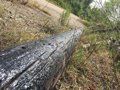
The last utility pole in Brownwood, Crow Road (photographed July 2016)

Over the next twenty-two years, a series of storms inundated Brownwood as the peninsula continued to subside, the result of decades of excessive groundwater extraction. In the end, the elevation of Brownwood dropped by ten feet. In August 1983 Hurricane Alicia sealed the neighborhood's fate as utilities were cut off and more than 300 residential properties were condemned. Those actions set in motion a series of lawsuits and property buyouts. 

By the early 1990s, most of the houses had been torn down and the debris cleared, but almost thirty years later, there are still plenty of signs of Brownwood's past; you just have to know where to look for them. The easiest place to start is on the shoreline.

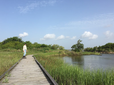
Tracey's Seine Sampling Boardwalk

Just past the Brownwood Education Pavilion (the highest point in the Nature Center), Crow Road is blocked by a gate, but there is a small parking area on the right-hand side of the road. Leave your car there and, after walking around the gate, cross a bridge. Immediately to the right is Tracey's Seine Sampling Boardwalk. (In case you are curious, seining is a method of collecting aquatic samples using a large seine net or a smaller handheld net.) As you cross the boardwalk, look for signs of wildlife below it; you just might see a group of blue crabs scurrying in the sand.

Basket flowers and bumblebees

At the end of the boardwalk, the path narrows as it heads toward Crystal Bay. When I was there this summer, basket flowers, some as high as six feet, were buzzing with bumblebees. When you get to the bay, walk along the shore among the riprap and broken concrete slabs, but be careful—the surfaces are slick and uneven. Ten to fifteen feet from the land, you will also see the concrete foundation for a boathouse.

Boathouse ruins

The best time to explore the shoreline is during low tide, especially after a cold front has blown through and pushed the water out of the Ship Channel into Galveston Bay. Low tide provides greater access to the beach and a better chance of discovering hidden objects, such as broken cups and saucers, otherwise buried in the sand.

Shell, brick fragment, and crockery on Wooster Point

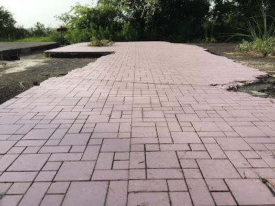
One of my favorite spots in the Nature Center is Wooster Point, where Crow Road / Bayshore Drive meets Mapleton Avenue. A short path leads to the point and a covered picnic area. Next to the structure is a footprint of a house, its pink ceramic tile still glued to the bathroom floor. It must have looked stylish in its heyday of the 1950s. Its geometry of squares and tiles still mesmerizes.

House foundation, Wooster Point

You have to use your imagination to see what used to lie beyond Wooster Point as the ground sloped toward Scott Bay. Wooster Cemetery was a small family graveyard associated with the original community of Wooster (established in 1892). The first burial, for ten-year-old Martin Elmar Wooster, occurred in 1894, and the last person buried there (in 1969) was the poetically named Edna Sjolander, who died at age forty-three. As subsidence took its toll on Brownwood, the cemetery slowly slipped underwater. Most of the graves were relocated, and by 1980 the cemetery had disappeared and only empty crypts were visible at low tide.

My colleague Georgeann standing on riprap at Wooster Point

On a trip to the Nature Center this summer, my colleague Georgeann and I investigated Wooster Point. In the photograph above, she stands with her back to what used to be Wooster Cemetery. The stretch of land in the distance, rising eight feet above the channel, is the southern section of Goat Island, which was partially reconstructed in 2003-2004.

Georgeann and I were doing reconnaissance for a Lee College Honors class, the Human Condition, that we team-teach. For a unit entitled "How Do We Connect with Nature?" we have scheduled a field trip to the Nature Center, where our students will learn about and consider the historical, cultural, and environmental impacts on Brownwood and the Baytown Nature Center.

Brownwood Education Pavilion, looking toward the San Jacinto Monument

To continue your tour, reverse your route past the Education Pavilion, down Crow Road. If you want to explore the Children's Nature Discovery Area and the public fishing piers, take a left where the road forks on Bayshore Drive. Turn right at the fork to see the most spectacular ruins of Brownwood, the first of which is easy to miss. Look for a dirt road leading to a popular fishing spot on Burnet Bay. Buried in the weeds on the left is the outline of a swimming pool.

Overgrown swimming pool

Beyond the pool, hidden in a tall stand of trees on the southern side, is a house foundation. Crawl through the thicket (how can you resist?) and you will find a rough green flooring affixed to the concrete slab, presumably to provide a textured surface for walking around the pool.

Foundation and original flooring

One of the gentle ironies of the Baytown Nature Center is the juxtaposition of nature and civilization. When I visited this summer, wildflowers were in full bloom, often sprouting among the ruins, as was the case with the basket flower in the photograph below.

Basket flower among house ruins

The shoreline is completely open as you leave the ruins and continue walking north along Burnet Bay. A hundred yards or so up the beach, you will see a concrete structure. You may not recognize what it is at first, but you are looking at another swimming pool but from an unexpected vantage point. The bottom edge of the pool rises more than six feet above the ground. Imagine the grassy lawn that used to extend twenty or more yards to the waterfront. This is the best visual lesson in subsidence and beach erosion the Nature Center has to offer. Where my wife Susan is standing in the photograph below, the far edge of the pool is a full foot above her head.

Susan below the edge of a swimming pool

This swimming pool may be easier to spot on your initial drive from the visitor center. As Brownwood Drive crosses the water and curves left onto Bayshore Drive, look to the right toward the bay. The pool appears to jut upward and is filled with shrubs and mature trees. The concrete encasement must have provided just the right soil conditions, protecting the trees from the brackish water of Burnet Bay.

The pool as seen from Bayshore Drive

Take a shallow dip in the pool and you will enjoy the most extraordinary view of the bay.

A dip in the pool

Running your hands over the cool blue ceramic tile, you will notice that someone, strangely (dangerously), thought this was a good place to do a little target practice.

Target practice

After soaking in the pool, head back to your car and drive toward the main entrance of the Nature Center. Just before Brownwood Drive makes a sharp left-hand turn, you will see a large sign on the right for the Golden Bloom Pond Trail. This is my favorite hike in the Nature Center. The trail takes you through the woods and bends around the eastern edge of Cypress Pond before making a sharp turn to the left. A long boardwalk returns you to continue the direction you started, back to a wooded trail that runs along the eastern side of the Nature Center, heading south to Scott Bay. On your left is a chain-link fence, and through it you can see a neighborhood that survived the devastation of Carla, Alicia, and dozens of named and unnamed storms. You are walking along an edge, a zone between ecoregions. You are walking on the dividing line between houses that were deemed habitable and those that were condemned.

End of the trail—the path to Scott Bay Overlook

The trail ends at Scott Bay Overlook, a relatively high point on the peninsula, which explains why one neighborhood continued to exist (at least for now) while another sank into history. The overlook offers a stunning view of the bay. Sitting on a covered bench, you can see the Fred Hartman Bridge in the distance. Feeling the sea breeze and looking up into the branches of an enormous shade tree, you might wonder how the tragedy of Brownwood ever came to be.

Sunflower at land's end

Walk down to the shore and enjoy, once again, the beautiful wildflowers. Just beyond them are more slabs of concrete and a more substantial bulwark made up of encased steel beams. They are there to protect the shoreline, to hold back the tide. The next time a major storm strikes the Gulf of Mexico and Galveston Bay, however, you can be sure the storm surge will rise above the riprap and steel and wreak havoc on this small peninsula yet again.

Industrial riprap on Scott Bay

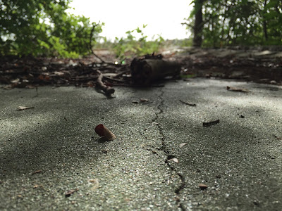
During my last visit to the Baytown Nature Center, I found a partial brick in the water off Wooster Point. Only half the lettering remained, but the whole brick was originally stamped with the following words: "ACME BRICK CO. EVERLAST." That last one is the most important one and should give each of us pause.

A potent reminder of human folly

In my next installment I will consider the signs of Brownwood and the Baytown Nature Center and the stories they tell.